Action off Cartagena : the wreck of the San José
[Originally posted June 7, 2016]
 | |
"Action off Cartagena", 1708
|
After three hundred years; the wreck of the San José has been found.
The Spanish galleon, San José, perished in a battle during the Spanish War of Succession (1701-1714) reportedly carrying the richest cargo to have ever been lost at sea.
The Colombian Government reported news of the discovery of the San José through world media outlets in December, 2015. The identity of the wreck was confirmed by deep dive photographs taken by the Colombian navy; showing the galleon's unique dolphin engravings on her bronze cannon.
Once again, the San José, is the coveted prize of a battle being waged through a minefield of international law courts to establish the ownership of the wreck; potentially valued in multi-billions of dollars. In 2011, a US court decided that the shipwreck was the property of Colombia. This decision went against a salvage claim made by an American based company, 'Sea Search Armada', who maintained to have initially located and documented the wreck in 1982.
The search for the treasure-laden San José may be over but it is not the end of her story.
For researchers interested in this topical event, the RGSSA, holds an 18th and 19th century reference library of books and maps regarding the history of the Spanish conquest and colonisation of South America. Historical maps published in these volumes are works of art and must be seen to be fully appreciated. Reference information from these volumes in the Library often provide a unique perspective to historical events and the opinions of the day.
Information regarding shipwrecks is a specialty subject of the Collection with many reference volumes and maps detailing the circumstances and location of famous and obscure wrecks. The RGSSA's digital catalogue can be searched for the names of ships and shipwrecked vessels.
Did British guns cause the catastrophic events that sank the San José ...
The San José was sunk in an attack by four British warships led by Admiral Charles Wager (1666–1743) of the British Jamaica Station in a battle known as Wager's Action by the British or the Battle of Barú in Spanish records.
In March, 1707, Captain Charles Wager was appointed Commander-in-Chief of the British Jamaica Station in the West Indies by Prince George of Denmark (1653-1708); the consort of Queen Anne (1665–1714).
 |
| 'Sir Admiral Charles Wager', 1710 Oil by Sir Godfrey Kneller Royal Museums Greenwich |
Wager replaced Sir John Jennings (1664–1743) who had been promoted to vice admiral and sent to command the British fleet off Lisbon in 1708-1710. Established in 1655, the duty of the Jamaica Station, was to defend the English settlements and disrupt Spanish ports and shipping in the region.
Along with her sister ship, San Joaquin; the San José and the Santa Cruz formed the Spanish 'Tierra Firme Fleet' of 1708. At Portobelo, in modern Panama, the galleons took aboard a fabulous cargo in Inca gold, silver, pearls and emeralds, destined for the Spanish treasury of King Philip V (1683–1746). The fleet then headed to the port city of Cartagena de Indias (modern Colombia) with two small escorts; Carmen and Nietto, served by twelve supply ships in convoy with a heavily armed French squadron.
Captain general of the Spanish flagship, San José, was
Don José Fernández de Santillán, first Count of Casa Alegre.
Don José Fernández de Santillán, first Count of Casa Alegre.
The treasure aboard the San José was said to be valued at 10 million Spanish pesos but estimates vary depending on the reference source. Undoubtedly, the fleet's actual cargo inventory would be available from records held at the National Archives of Spain and at Lima. It is known that the Tierra Firme Fleet of 1708 carried great quantities of silver from the mines at Peru and Veracruz, pearls from the Island of Contadora, emeralds from Muzo and Somondoco and tens of millions of gold coins.
Captain Wager had been promoted to admiral when he wrote to the Board of Admiralty in London, April 13, 1708, with information regarding the Tierra Firme Fleet:
It is said that the king's money is ready to be shipped off [Portobelo]
and that it amounts to eleven millions of pieces of eight.

'Plan of Porto Belo'
engraved by Thomas Jefferys, 1762
Call Number: rgsp 917.29 J45
Refer: RGSSA catalogue
Variance in the estimates of the fleet's value may be due to errors in the exchange rate in currencies used by Spain and Portugal. Regardless, in 'reis or pesos', it was still a vast fortune and Admiral Wager most certainly intended to capture the fleet for the English Crown. Moreover, it was 'common knowledge' that Spanish galleons routinely carried civilian passengers in a practice to render them unfit for naval combat.
By all accounts; Admiral Wager did not place greed above honour. He would not have found it honourable to deliberately sink the San José with the knowledge that she carried civilian passengers. Nonetheless, they perished with the captain, officers and most of the crew.
Perhaps, the Admiral should be given the benefit of the doubt?
the Action off Cartagena de Indias
Aboard the HMS Expedition, Admiral Wager described the action on Friday, June 8, 1708:
It was just sunset when I engaged the Admiral [San José], and in about an hour and a half, it being then quite dark, the Admiral blew up. I being then along his side, not a half pistol's shot from him, so that the heat of the blast came very hot upon us and several splinters of plank and timber came on board us afire. We soon threw them overboard. I believe the ship's side blew out, for she caused a sea that came in our ports.Captain Arauz of the Spanish escort ship, Carmen, recounted:
She immediately sank with all her riches.
A great fire seemed to come from within the capitana [San José]. It rose to the topmast and topsails, giving the appearance of a volcano eruption. Accompanying this was a great pall of smoke that lasted for fifteen minutes. When it cleared, the capitana was gone!
Admiral Wager eventually disabled and captured the Santa Cruz but the San Joaquin escaped him into the safety of the Spanish harbour at Cartagena. The Santa Cruz carried an estimated £60,000 in cargo. The Admiral's share of proceeds from the Santa Cruz together with his flag share of other prizes taken in the West Indies meant that he returned to England a rich man. Wager's Action ended a few days later on the 12th June, 1708, for which he was knighted in the following year by Queen Anne.

'Plan of the harbour of Carthagena'
from surveys made by
Don Juan de Herrera, Chief Engineer at Carthagena
[Don Juan de Herrera y Sotomayor, 1667-1732]
'A description of the Spanish islands and settlements
on the coast of the West Indies'
engraved by Thomas Jefferys, 1762
Detail from map shown below
Don Juan de Herrera, Chief Engineer at Carthagena
[Don Juan de Herrera y Sotomayor, 1667-1732]
'A description of the Spanish islands and settlements
on the coast of the West Indies'
engraved by Thomas Jefferys, 1762
Detail from map shown below
Call Number: rgsp 917.29 J45
Refer: RGSSA catalogue

British naval justice, or ...
I understand Mr. Wager intends to bring the two captains that were with him to a trial, as soon as the ships from Great Britain arrive, that they may be able to make up a Court Martial. By the account that I have had from my own officers on board those ships and the lieutenants of them, Mr. Wager has had very foul play, but that will be best known when the Court Martial meets. The traders that have come from Porto Bell [Portobelo], say, that the Spaniards laugh [at us] ... This talk is enough to concern any true Englishman.
Admiral Wager presided over the court martials of Captain Simon (Timothy) Bridges of HMS Kingston and Captain Edward Windsor of HMS Portland. Both Captains were charged with 'poor performance'; found negligent in their failure to pursue the San Joaquin and dismissed from the navy without pension. Details regarding the exact charges of their 'poor performance' are not made clear.
Both Captains presented 'reasons' not to pursue the galleon which are not stated in the proceedings. It is known that Admiral Wager was disappointed with the small bounty from the Santa Cruz in comparison to the far greater prize that had escaped him on the San Joaquin.
Both Captains presented 'reasons' not to pursue the galleon which are not stated in the proceedings. It is known that Admiral Wager was disappointed with the small bounty from the Santa Cruz in comparison to the far greater prize that had escaped him on the San Joaquin.
While researching a previous post an opinion piece written about the Royal Navy vividly illustrates the perspective gained by using the RGSSA for research information not available from an internet search:
With the waning of the seventeenth century, buccaneering became a discredited profession; though, in Good Queen Bess's [Elizabeth I, 1533–1603] time, every navigator was a pirate and every buccaneer was a navigator, and so it continued through the days of the Stuarts.
Our 'Merrie Monarch' [Charles II, 1630–1685] made Morgan governor of Jamaica—Morgan, who with four hundred cut-throats, had sacked Panama in the sight of three thousand Spanish soldiers!
Dampier was a pirate too, and so was Sir Francis Drake—the latter the greatest and most cunning of all! For did he not waylay the bearers of government treasure on the Isthmus of Panama, and share the spoil with our Virgin Queen?—thus protecting himself from all unpleasant consequences, and from any unfavourable verdict which might be given by the Commission appointed by his Royal Mistress to enquire into his conduct, with the laudable object of maintaining peace and appeasing the indignation of the Spanish Government.--From On the track of a treasure (1904) : p. 13-14by Major H.G.F.E. de Montmorency (1868-1942)Royal Artillery, decorated, Boer War and First World WarRefer: RGSSA catalogueCall Number: rg 910.4 a 1904
A description of the Spanish islands and settlements on the coast of the West Indies: compiled from authentic memoirs, revised by gentlemen who have resided many years in the Spanish settlements; and illustrated with thirty-two maps and plans, chiefly from original drawings taken from the Spaniards in the last war, and engraved by Thomas Jefferys.
London : printed for T. Jefferys, 1762.Call Number: rgsp 917.29 J45
Refer: RGSSA catalogue
 |
| 'List of Plates' [32 maps with source references] |
This volume contains a 'History of Carthagena' (archaic English spelling) to the date of its publication in 1762 (p.12-22). Cartagena was then located in the Spanish Province of Tierra Firma (modern Colombia) that gave its name to the Spanish treasure fleets. Decades of fleets transported silver from the mines in the Viceroyalty of New Granada (1717–1819) to the treasury of the Spanish kings and were also known as the 'Silver Fleets.' A history of the Province of Tierra Firma (p. [1]-23) provides a description of its boundaries in the first paragraph:
"It is a very large territory, bounded by the sea on the north; by Caribana, and Guiana on the east;by Peru and the river of the Amazons on the south; and by the Pacific Ocean on the west."--p. [1]

'Plan of the City and Suburbs of Carthagena'
'From French authors'
[Survey prior to 1761 earthquake that destroyed the city]
[Survey prior to 1761 earthquake that destroyed the city]
Call Number: rgsp 917.29 J45

'References and Bastions'
Detail from above map:
'Plan of the City and Suburbs of Carthagena'
Call Number: rgsp 917.29 J45
"It was reported in the beginning of the present year, that great part of Carthagena was destroyed in an earthquake, but as the particulars of that dreadful account are not yet come to hand, we shall decline saying any more about it, only that we hope it is not true."--p. 22.
In 1761, a catastrophic earthquake devastated Cartagena and destroyed all the adobe buildings. The map shown is possibly the last published map of the city to show the location of landmark buildings prior to the earthquake. The map lists 26 buildings that appear to mainly be churches.
A voyage to the islands Madera, Barbados, Nieves, St. Christophers and Jamaica : with the natural history of the herbs and trees, four-footed beasts, fishes, birds, insects, reptiles, &c. of the last of those islands; to which is prefix'd an introduction, wherein is an account of the inhabitants, air, waters, diseases, trade &c of that place, with some relations concerning the neighbouring continent, and islands of America ... by Hans Sloane.
Description: 2 volumes, 274 plates (folded) : illustrations, map, music ; 36 cm.
London : printed by B.M. [R. Bentley and M. Magnes] for the author, 1707-1725.Call Number: rgsp 917.29 S634 (Vol. 2 only)Refer: RGSSA catalogue

"A New Chart of the Western Ocean"
A detail from the folded map shown below

Example of botanical sketches from
Sloane's Natural History of JamaicaIllustration [tab] 146 (below)

Available online from the Biodiversity Heritage Library
https://www.biodiversitylibrary.org/bibliography/642#/summary
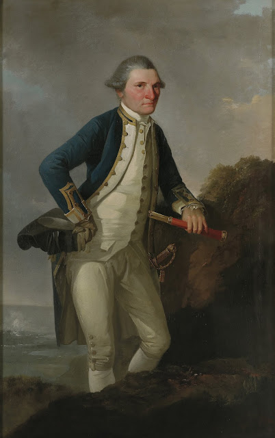
Captain Cook's journal during his first voyage round the world made in H.M. Bark "Endeavour", 1768-71 :a literal transcription of the original manuscripts. : with notes and introduction.London : Elliot Stock, 1893.Call Number: rgsp 910.41 C771 cFrontispiece Captain Cook's JournalPortrait of Cookby Sir Nathaniel Dance-Holland, c.1775National Maritime Museum, Greenwich

postscript
Since the original posting in 2016 a report was issued by the Rhode Island Marine Archaeology Project regarding the possible discovery of James Cook's Endeavour.
HMS Endeavour, may lie in waters off the state of Rhode Island in Newport Harbour.
Aboard Endeavour, James Cook (1728-1779), claimed Australia as British territory in 1770 for King George III. The ship was last seen in 1778 by which time she was being used as a transport ship during the American Revolution (1765-1783). The Endeavour is the 'most important' ship in Australian history and a specialty subject of collection for the Library.
In Australia, the Historic Shipwrecks Act 1976, protects historic wrecks and associated relics that are more than 75 years old and in Commonwealth waters. Essentially, historic wreck sites within Australian territorial waters cannot be salvaged for commercial purposes and are protected and preserved in situ.
Refer:
'Is it the Endeavour: 2019 Report of Results'
Also refer:
'Battle begins over world's richest shipwreck'. National Geographic.
Retrieved 15 May 2016 from
'Captain James Cook's ship Endeavour believed found in US.'
Retrieved 3 April, 2016 from
Originally posted June 7, 2016 on our previous blog site
All external links retrieved September 2019
Posted and researched by Sandra ThompsonRGSSA remote cataloguer
--


Comments
Post a Comment